
 5 months ago
101
5 months ago
101
ARTICLE AD BOX
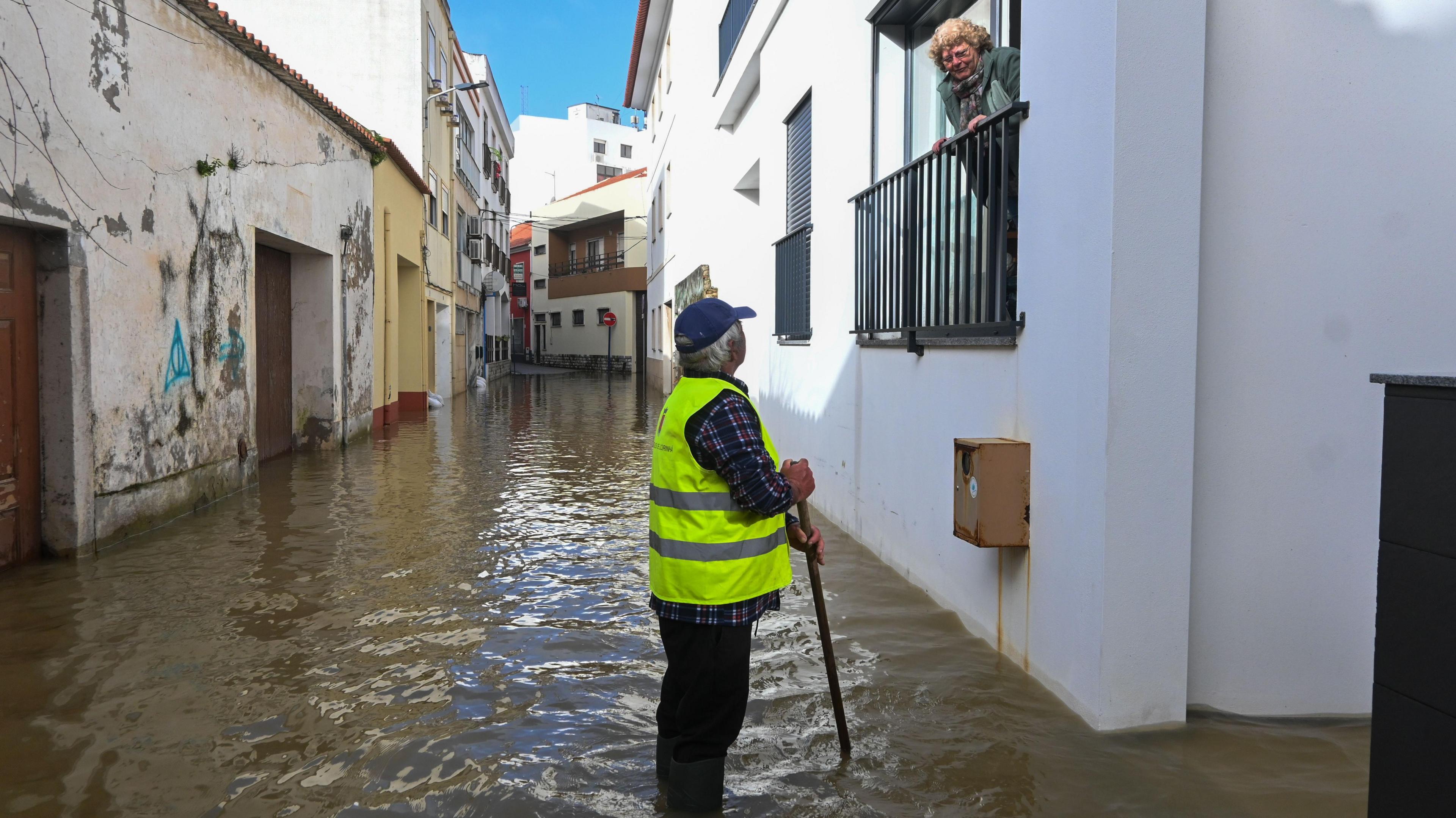
Flooding in Portugal after days of heavy rain since the start of the year
ByDarren Bett
Lead Weather Presenter
It is not just the UK that has been enduring some very wet weather recently as heavy rain and storms have led to extensive flooding in Europe and north-west Africa.
Spain, Portugal, Morocco and Tunisia are among the places that have had so much rainfall thousands of people have been evacuated from their homes, roads closed and rail services disrupted.
Other parts of Europe have been gripped by very cold weather since the start of the year.
All this is due to a weather pattern that hasn't changed for weeks.
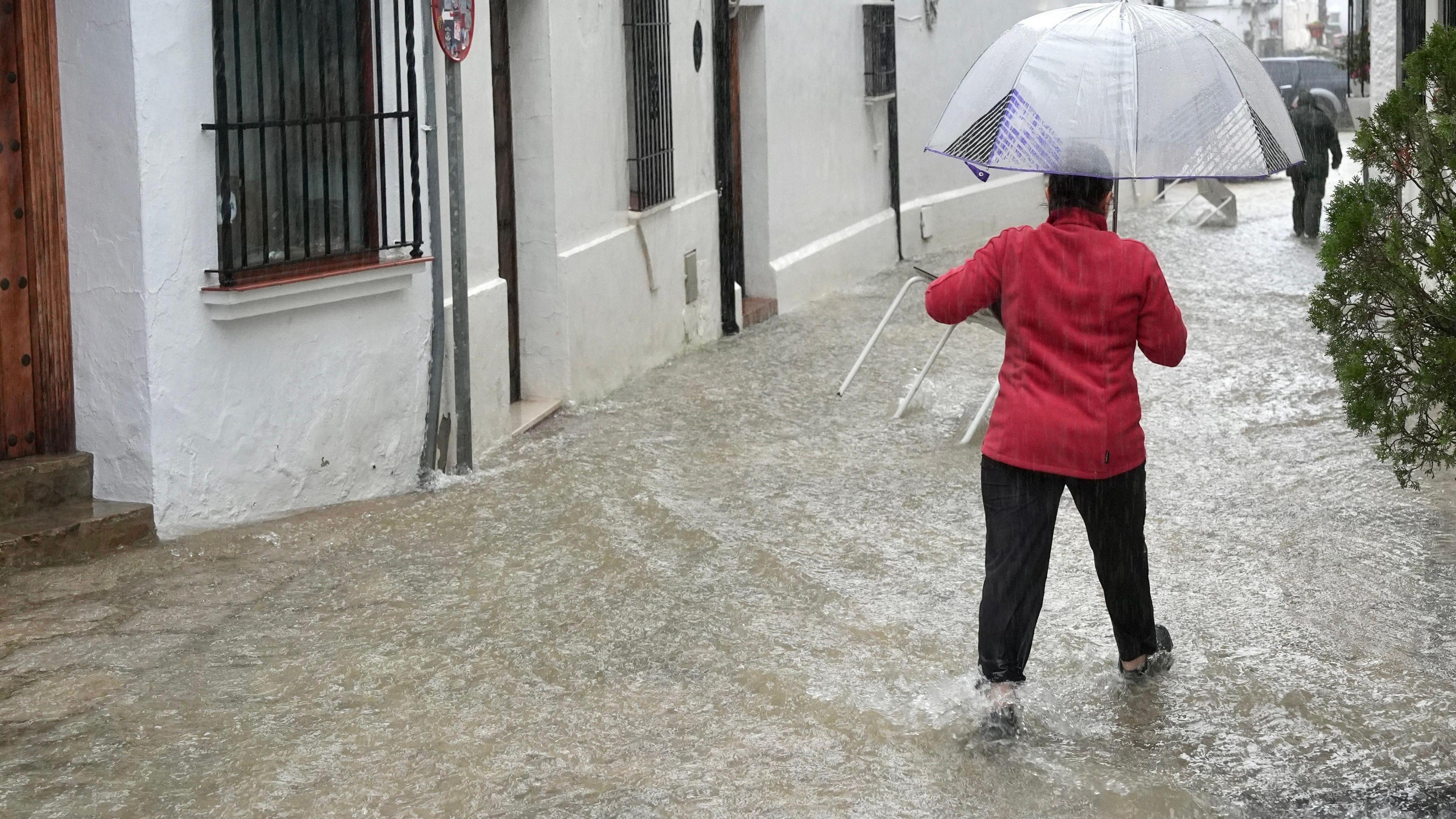
Flooded streets in Grazalema, Andalusia, following weeks of heavy rain in Spain
...has been falling mainly in the south of the country.
It has been exceptionally wet in the southern region of Andalucia where 3,500 people have been evacuated. River levels have reached record highs, more than 100 roads have been closed in affected areas due to flooding, landslides or fallen trees and some high speed rail services were suspended.
Grazalema in the foothills of the Sierra del Pinar range, has recorded 672mm (26.4 inches) of rain in a day-and-a-half. This is almost the same amount that London gets in a year.
This rainfall mostly came from Storm Leonardo which has also brought flooding to Portugal. It is the sixth major low-pressure system to hit the Iberian peninsula in 2026.
Further warnings of heavy rain, strong winds and mountain snow remain in place for the next few days.
Unusually wet in north-west Africa
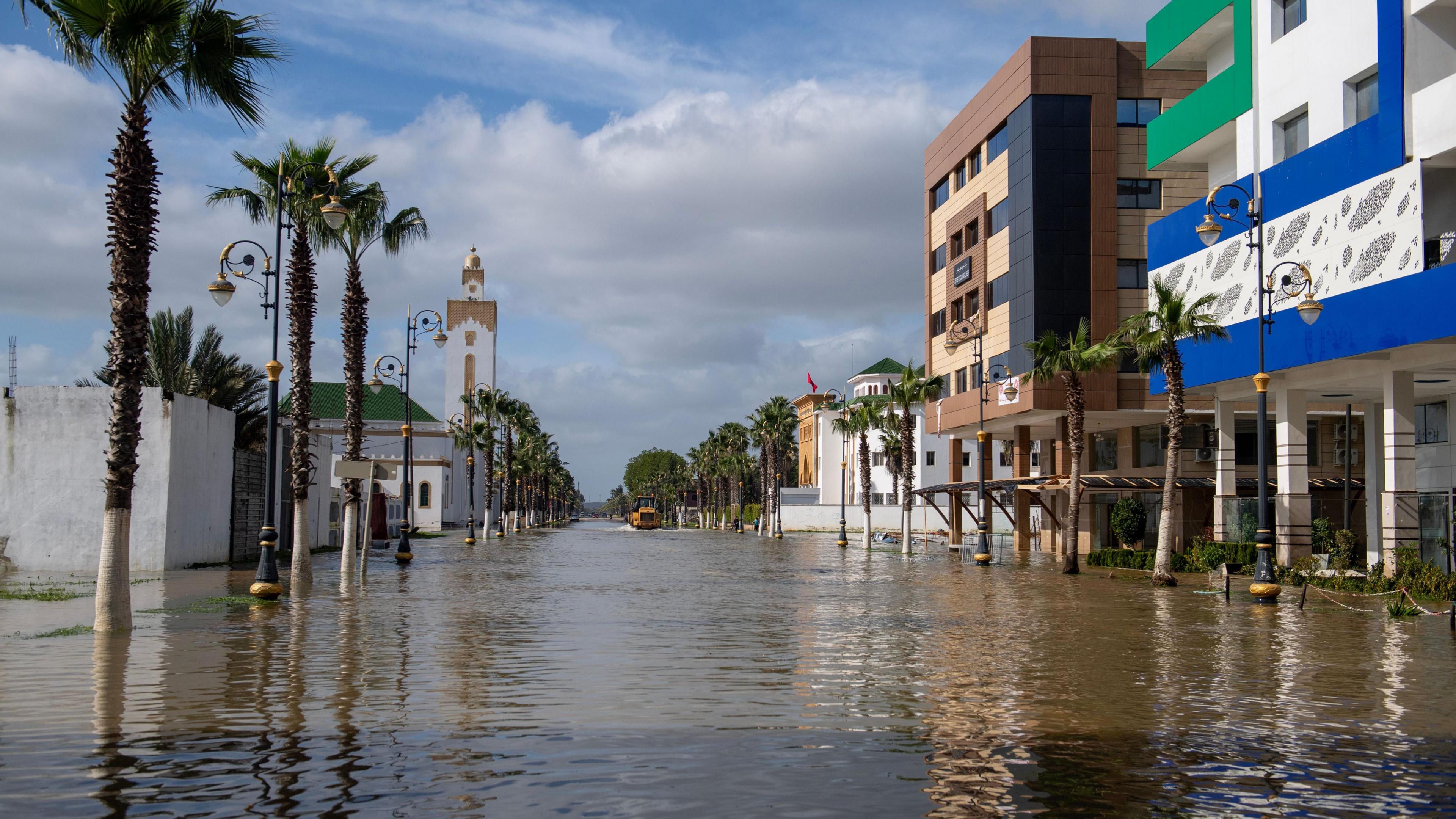
Ksar El Kebir in NW Morocco is largely deserted after the Loukkos River burst its banks last week
Tunisia saw its heaviest rainfall in more than 70 years last month. There has also been severe weather and flooding in Algeria.
Morocco has been particularly badly hit in recent weeks. Last month the port of Tangier saw around four times its January average rainfall and more heavy rain hit the north on Wednesday in association with Storm Leonardo.
The army has been deployed to help with evacuations amid a red alert for more heavy rainfall this week. More than 100,000 people have been evacuated already.
Authorities have urged residents of flood prone areas in the country's north-western plains to leave immediately with rising threats of inundation from heavy rain, swollen rivers and the release of more water from full dams.
The exceptional rainfall has ended a seven-year drought that had pushed Morocco to accelerate investments in desalination.
Extreme cold in north-east Europe
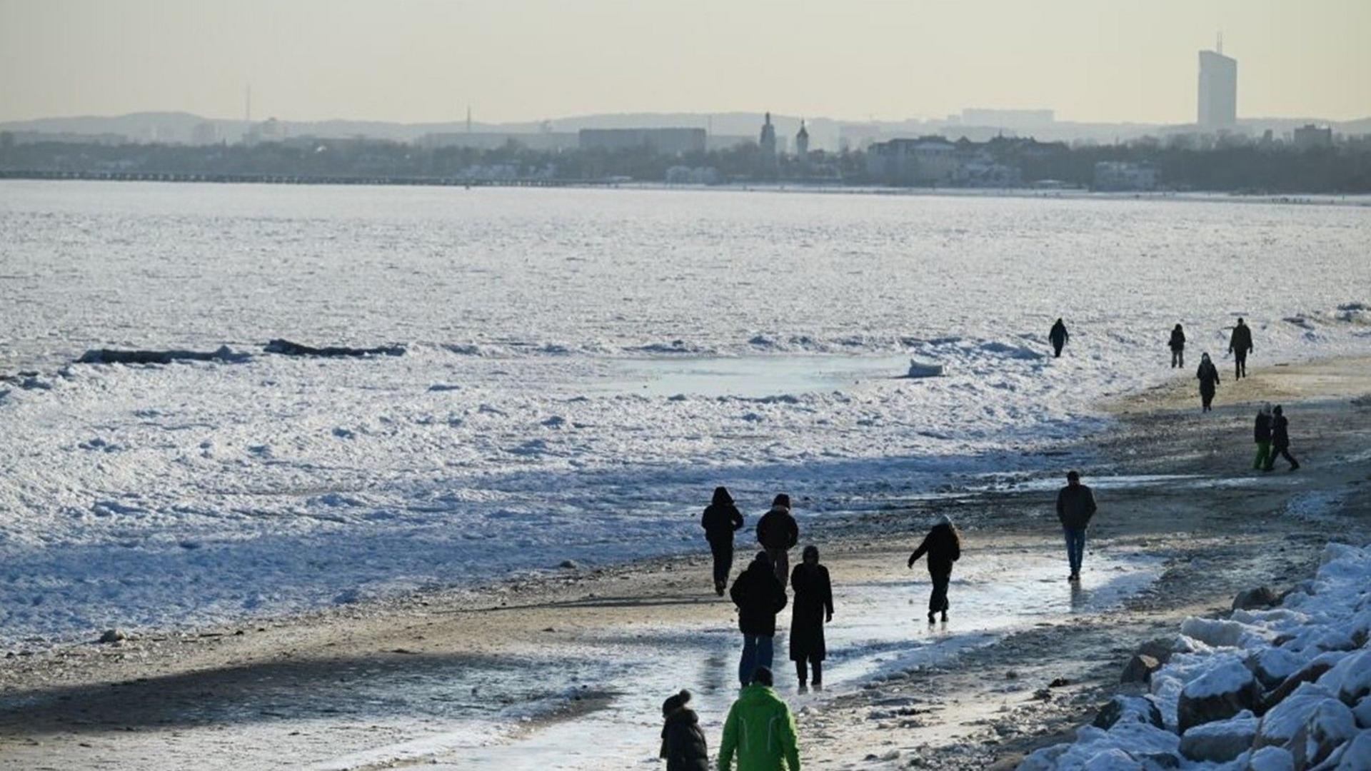
Coastal ice floes in the Baltic Sea off the coast of Poland caused by the prolonged spell of cold weather and high pressure
While is has been very wet in southern and western Europe, Scandinavia and the Baltic has been exceptionally cold.
In Lithuania temperatures fell to -34.3C (-29.7F) on Monday morning – this is the lowest temperature recorded in the country since 1996.
You would expect Lapland to be cold at this time of year but parts of northern Sweden have had their second coldest January on record.
The persistent cold weather has extended down to Ukraine too. Temperatures in Kyiv have dropped as low as -20C (-4F) and the temperature has risen above freezing on only six days so far this year.
When will the weather change?
The extreme weather in Europe and north-west Africa is mainly due to the weather pattern having not changed for weeks.
That's down to a stubborn area of high pressure which has been parked over Scandinavia this year and is responsible for the cold weather here.
This high then blocks areas of low pressure and milder, wet weather from pushing across from the Atlantic and the jet stream is deflected further south. This is why it has been so wet in the UK and other western parts of Europe as well as through the Mediterranean.
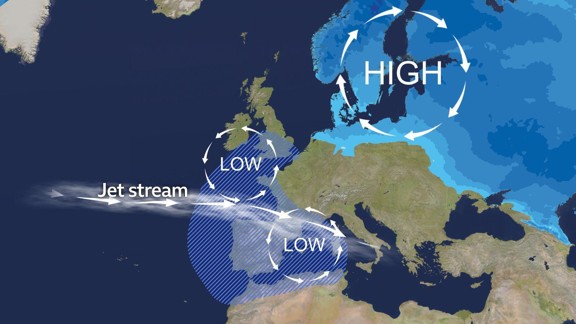
Typical weather pattern for the last few weeks showing the cold air and area of wettest weather. This pattern looks set to continue into next week
Cold, blocking areas of high pressure are notoriously difficult to shift at this time of year. North-east Europe looks like it will stay very cold for much of February. As winds strengthen in some places there will be an added wind-chill.
Some of this cold air could head to the UK later next week and bring the risk of frost, ice and snow.
Areas of low pressure will continue to bring spells of wet and windy weather into central and southern Europe. This will bring the risk of flooding and damage and disruption from strong winds.
For southern Iberia and north-west Africa there may be a glimmer of hope. An area of high pressure may build across from the Canary Islands and bring some much needed dry weather later next week. How long that lasts though remains to be seen.


 English (US) ·